Certified SDVOSB · FAA Part 107 · Veteran-owned

Mission-grade mapping for the Florida Gulf Coast.

Weekly drone flights, 4K deliverables, and a linked orthomosaic map — on your project manager's desk by Monday morning.

Lakewood Ranch · FL Insured to $1M NAICS 541370

Proof

Numbers from real projects.

5hr
staff hours saved per Aeris Mapping site visit
42hr
flight hours
209flights
total flights
327miles
flight miles

Services

Four ways we document your site.

01  Most requested

Weekly progress documentation for the GC who needs Monday answers, not Friday excuses.

Fly your site weekly or bi-weekly. 4K edited videos, geo-tagged stills, and a fresh orthomosaic on a single shareable link. Built for general contractors and construction companies running multi-phase commercial work.
Most popular Recurring 48hr SLA Multi-phase
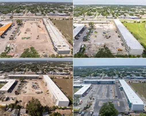
Aerial drone view of the Nest Apartments construction site near Lakewood Ranch, Florida Captured recently
Nest Apartments Flight 8 | 13 | 23 | 33 · 200 ft AGL · 30° oblique

02  Project-wide

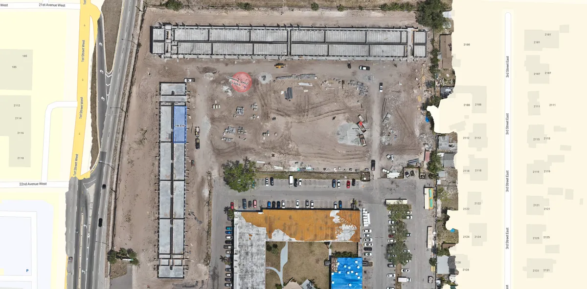
Orthomosaic site maps for the owner who wants one map. The whole project, not a stack of photos.

Aeris Mapping processed 2D maps using Real-Time Kinematic positioning. Stockpile volumetrics, cut-fill analysis, elevation deltas, and 3D maps on request. Delivered as a shareable web map plus raw GeoTIFF for your GIS.

Project Sub-3cm Pix4D GeoTIFF
Orthomosaic site map of the Nest Apartments project produced by Aeris Mapping
Nest Apartments — orthomosaic 26 Apr 2025 · 429 images · 1.29 cm/px GSD · GeoTIFF · 4K

Thermal & inspection

FLIR thermal sweep with annotated heat-loss report. Roofing, solar, substation, insurance documentation.

Project Annotated

Storm-loss & claims

Same-week claim-ready imagery, timestamped, geo-tagged, tied to a pre-event map when available.

On-demand Same-week

About

Founded by an Army Colonel and his son.

Aeris Mapping is a veteran-owned geospatial firm based in Lakewood Ranch, FL, founded in 2023 by Jason Cobb and his father, William Cobb, a retired Army Colonel with more than three decades in uniform.

We're a small team by design, and both founders are pilots. Every mission is planned and flown by a founder-pilot, and every dataset is checked by the people who captured it — no subcontractors, no offshore editing. That's what "mission-grade mapping" means to us: high-quality deliverables you can stake a project or contract on.

Certification
FAA Part 107
Designation
Certified SDVOSB
Insurance
$1M
Fleet
DJI M3T · M3 Pro · Mini Pro 3
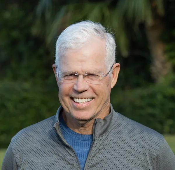
Jason Cobb, Co-Founder and CEO of Aeris Mapping
Jason Cobb
Co-Founder & CEO · Chief Pilot
William Cobb, Co-Founder and CTO of Aeris Mapping
William Cobb
Co-Founder & CTO · US Army Col. (Ret.)

Coverage

On-site this week, statewide on request.

We're based in Lakewood Ranch and fly the Gulf Coast and Central Florida on a regular schedule. No travel fees within 150 miles. Anywhere else in Florida, availability depends on the current schedule.

Lakewood Ranch HQ
Sarasota 12 mi
Bradenton 8 mi
Tampa 52 mi
St. Petersburg 47 mi
Fort Myers 76 mi
Naples 115 mi
Orlando 108 mi

Contact

File a flight request.

A 25-minute call. We'll walk through your project, your deliverable cadence, and whether weekly flights make sense.

We reply same business day. Discovery calls run 25 minutes.